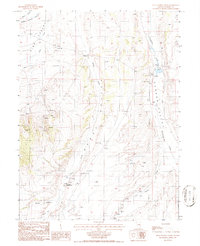
1986 Map of Pete Hanson Creek
USGS Topo · Published 1986About this map
Pine Valley, Denay Valley, and Garden Valley converge in this high-elevation Nevada landscape, defining a network of drainages and ranch lands in the mid-1980s. The northern reaches are shaped by Horse Creek and Pine Creek, while the eastern portion of the sheet is dominated by the course of Henderson Creek as it flows past the J D Ranch. This cattle operation stands as a primary point of human settlement, situated near several corrals and a large well system that support livestock in the arid valley floor.
Find a feature on this map
20 named features on this map. Tap any name to fly to it.
Don’t see what you’re looking for? This feature index may not catch every label — zoom into the map to look around manually.
Map Details
Editions of this 1986 Pete Hanson Creek Map
This is the sole edition of this map. No revisions or reprints were ever made.
Other maps of this area

1926 · Roberts Mountains
USGS Topo · 1:250,000

1929 · Roberts Mountains
USGS Topo · 1:250,000

1937 · Mineral Hill
USGS Topo · 1:48,000

1943 · Mineral Hill
USGS Topo · 1:62,500

1949 · Garden Valley
USGS Topo · 1:62,500

1949 · Roberts Creek Mtn
USGS Topo · 1:62,500

1951 · Roberts Creek Mtn
USGS Topo · 1:62,500

1951 · Garden Valley
USGS Topo · 1:62,500

1955 · Millett
USGS Topo · 1:250,000

1955 · Winnemucca
USGS Topo · 1:250,000