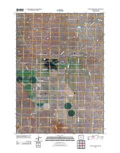
2011 Map of Peters Creek Sink
USGS Topo · Published 2011About this map
Peters Creek Sink and the surrounding high desert of Lake County characterize this quiet corner of Oregon as it appeared in the early 21st century. The landscape is defined by its arid hydrology, where the intermittent waters of Peters Creek flow toward the closed basin of Peters Lake. This area of the Sage Plains is marked by a grid of rural roads and tracks that follow the section lines of the public land survey system. The names of these thoroughfares, such as Grace Cabin Rd, School House Rd, and Stone House Rd, suggest the locations of early ranching outposts and former community landmarks. To the south, the terrain rises toward Bunchgrass Butte, while volcanic history is evident near Lava Rd in the southwest. The map documents a sparsely populated region where infrastructure is limited to essential county routes like County Hwy-S 128.
Find a feature on this map
17 named features on this map. Tap any name to fly to it.
Don’t see what you’re looking for? This feature index may not catch every label — zoom into the map to look around manually.
Map Details
Editions of this 2011 Peters Creek Sink Map
This is the sole edition of this map. No revisions or reprints were ever made.
Other maps of this area

1955 · Crescent
USGS Topo · 1:250,000

1957 · Crescent
USGS Topo · 1:250,000

1958 · Crescent
USGS Topo · 1:250,000

1970 · Crescent
USGS Topo · 1:250,000

1981 · Fossil Lake
USGS Topo · 1:24,000

1981 · Mean Rock Well
USGS Topo · 1:24,000

1982 · Peters Creek Sink
USGS Topo · 1:24,000

1982 · Christmas Lake
USGS Topo · 1:24,000

1982 · Jacks Place
USGS Topo · 1:24,000
1983 · Crack-in-the-Ground
USGS Topo · 1:24,000