
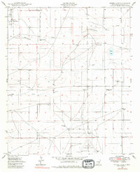
1949 Map of Peters Lake
USGS Topo · Published 1949About this map
Walker Air Base Auxiliary Landing Field No 1 and Walker Air Base Auxiliary Landing Field No 3 anchor this New Mexico landscape during the post-war expansion of military aviation. The terrain is defined by the ephemeral hydrology of Thirteenmile Draw and Zubi Draw, leading toward the small catchment of Peters Lake. A sparse but distinct pattern of ranching and early settlement is evident through family-named landmarks like Jenkins Ranch and the Loving Place (Aban'd). The map also records the vital necessity of water in this arid environment, noting numerous groundwater sources such as Peters Well and Brown Bros Well. Several sites, including the Blackdom Well (Aban'd) and Higgs Well (Aban'd), are already marked as abandoned by the late 1940s, reflecting the shifting fortunes of homesteading in Chaves County.
Find a feature on this map
19 named features on this map. Tap any name to fly to it.
Don’t see what you’re looking for? This feature index may not catch every label — zoom into the map to look around manually.
Map Details
Editions of this 1949 Peters Lake Map
2 editions found
Other maps of this area

1949 · Hondo Reservoir
USGS Topo · 1:24,000

1949 · Roswell South
USGS Topo · 1:24,000

1949 · Juan Lake
USGS Topo · 1:24,000

1950 · Dexter West
USGS Topo · 1:24,000

1950 · South Spring
USGS Topo · 1:24,000

1952 · Hagerman SW
USGS Topo · 1:24,000

1955 · Hackberry Ranch
USGS Topo · 1:24,000

1955 · Kincaid Ranch
USGS Topo · 1:24,000

1955 · Roswell
USGS Topo · 1:250,000

1958 · Roswell
USGS Topo · 1:250,000