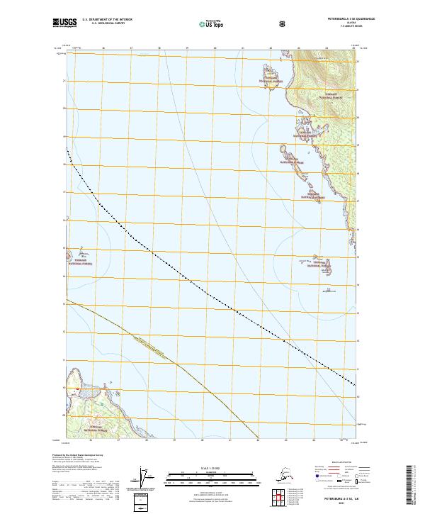
2021 Map of Petersburg A-3 SE
USGS Topo · Published 2021About this map
Clarence Strait dominates this maritime landscape, serving as a primary waterway through the Alexander Archipelago between the Wrangell City and Borough and Prince of Wales-Hyder Census Area. The coastal terrain is defined by complex shorelines and small archipelagos, including the Screen Islands and Abraham Islands. On the eastern shore, the topography rises toward Steamer Knoll, while the western edge features the entrance to Johnson Cove. This 2021 survey shows the reach of the Tongass National Forest across nearly every landmass, from the larger Lincoln Island to isolated hazards like Lincoln Rock and Deichman Rock. Infrastructure is minimal in this wilderness area, notably represented by the Coffman Cove Loop road skirting the southern coastline.
Find a feature on this map
19 named features on this map. Tap any name to fly to it.
Don’t see what you’re looking for? This feature index may not catch every label — zoom into the map to look around manually.
Map Details
Editions of this 2021 Petersburg A-3 SE Map
This is the sole edition of this map. No revisions or reprints were ever made.
Other maps of this area

1948 · Petersburg A-2
USGS Topo · 1:63,360

1949 · Craig D-3
USGS Topo · 1:63,360

1949 · Craig D-2
USGS Topo · 1:63,360

1949 · Petersburg A-3
USGS Topo · 1:63,360

1950 · Craig D-3
USGS Topo · 1:63,360

1951 · Craig D-2
USGS Topo · 1:63,360

1952 · Petersburg
USGS Topo · 1:250,000

1953 · Petersburg A-3
USGS Topo · 1:63,360

1953 · Petersburg A-2
USGS Topo · 1:63,360

1957 · Craig
USGS Topo · 1:250,000