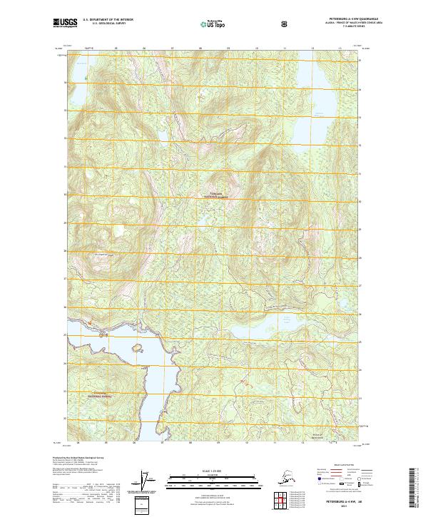
2021 Map of Petersburg A-4 NW
USGS Topo · Published 2021About this map
Tongass National Forest encloses this heavily forested region of Prince of Wales Island, where the landscape is defined by rugged topography and complex hydrological networks. The interior is marked by significant elevations like El Capitan Peak and unique geological features including a Sink Hole and the Cavern Hills near Cavern Lake. Water dominates the eastern and southern edges, from the expansive Salmon Bay Lake to the tidal reaches at Cape Pole and Aneskett Point. Access across the island is facilitated by the North Prince of Wales Road and an intricate system of forest tracks such as 20008789 Road Trl and the 2720000 Rd Cavern Lake Trl, which navigate between prominent landmarks like Bowl Face and Double 1000 Knobs.
Find a feature on this map
42 named features on this map. Tap any name to fly to it.
Don’t see what you’re looking for? This feature index may not catch every label — zoom into the map to look around manually.
Map Details
Editions of this 2021 Petersburg A-4 NW Map
This is the sole edition of this map. No revisions or reprints were ever made.
Other maps of this area

1949 · Petersburg B-5
USGS Topo · 1:63,360

1949 · Petersburg A-5
USGS Topo · 1:63,360

1949 · Petersburg A-4
USGS Topo · 1:63,360

1949 · Petersburg B-4
USGS Topo · 1:63,360

1951 · Petersburg B-4
USGS Topo · 1:63,360

1952 · Petersburg
USGS Topo · 1:250,000
1953 · Petersburg B-5
USGS Topo · 1:63,360

1953 · Petersburg A-5
USGS Topo · 1:63,360

1953 · Petersburg A-4
USGS Topo · 1:63,360

1960 · Petersburg
USGS Topo · 1:250,000