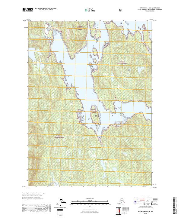
2021 Map of Petersburg A-4 SE
USGS Topo · Published 2021About this map
Whale Pass serves as a central coastal feature on Prince of Wales Island, marking the transition between the intricate waterways and the deep woods of the Tongass National Forest. This modern survey reveals a landscape shaped by both water and remote infrastructure, where Neck Lake and the drainage of Mabel Creek reach toward the coast. The map highlights the rugged maritime geography of the Alexander Archipelago, including Thorne Island, Mabel Island, and the Rookery Islands within Rocky Bay. Inland, the presence of specific service routes like the Whale Pass East TTF 11 and the Sarkar Canoe Route Trl provides evidence of the forest management and recreational networks that sustain this isolated coastal community.
Find a feature on this map
21 named features on this map. Tap any name to fly to it.
Don’t see what you’re looking for? This feature index may not catch every label — zoom into the map to look around manually.
Map Details
Editions of this 2021 Petersburg A-4 SE Map
This is the sole edition of this map. No revisions or reprints were ever made.
Other maps of this area

1949 · Craig D-3
USGS Topo · 1:63,360

1949 · Petersburg A-3
USGS Topo · 1:63,360

1949 · Craig D-4
USGS Topo · 1:63,360

1949 · Petersburg A-4
USGS Topo · 1:63,360

1950 · Craig D-3
USGS Topo · 1:63,360

1951 · Craig D-4
USGS Topo · 1:63,360

1952 · Petersburg
USGS Topo · 1:250,000

1953 · Petersburg A-4
USGS Topo · 1:63,360

1953 · Petersburg A-3
USGS Topo · 1:63,360

1957 · Craig
USGS Topo · 1:250,000