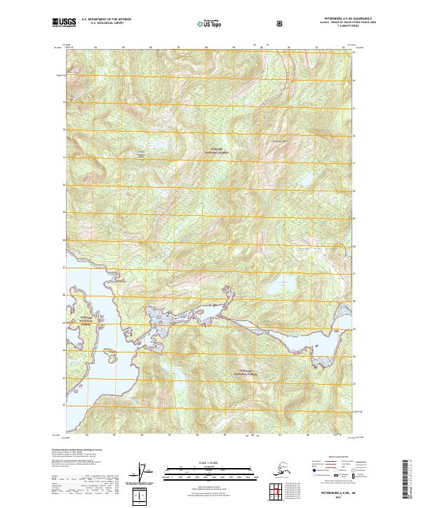
2021 Map of Petersburg A-5 NE
USGS Topo · Published 2021About this map
Prince of Wales Island dominates this portion of the Tongass National Forest, characterized by a complex network of waterways and timber-management infrastructure. The geography is defined by narrow channels like Dry Pass and the El Capitan Passage, which separate the main landmass from smaller features such as Fontaine Island. High-elevation points including Perue Peak and Red Bay Mtn rise above the coastal lowlands, providing significant relief across the island's interior. A system of forest roads and trails, such as the 2080000 Rd Big Creek Trl and the Hole In Wall Spur TW, indicates the ongoing intersection of remote wilderness with industrial access. These routes connect inland basins containing Sutter Lake and El Capitan Lake to the tidal waters, reflecting the logistical patterns of Southeast Alaska's maritime and forest-based economy.
Find a feature on this map
32 named features on this map. Tap any name to fly to it.
Don’t see what you’re looking for? This feature index may not catch every label — zoom into the map to look around manually.
Map Details
Editions of this 2021 Petersburg A-5 NE Map
This is the sole edition of this map. No revisions or reprints were ever made.
Other maps of this area

1949 · Petersburg B-5
USGS Topo · 1:63,360

1949 · Petersburg A-5
USGS Topo · 1:63,360

1949 · Petersburg A-4
USGS Topo · 1:63,360

1949 · Petersburg B-4
USGS Topo · 1:63,360

1951 · Petersburg B-4
USGS Topo · 1:63,360

1952 · Petersburg
USGS Topo · 1:250,000
1953 · Petersburg B-5
USGS Topo · 1:63,360

1953 · Petersburg A-5
USGS Topo · 1:63,360

1953 · Petersburg A-4
USGS Topo · 1:63,360

1960 · Petersburg
USGS Topo · 1:250,000