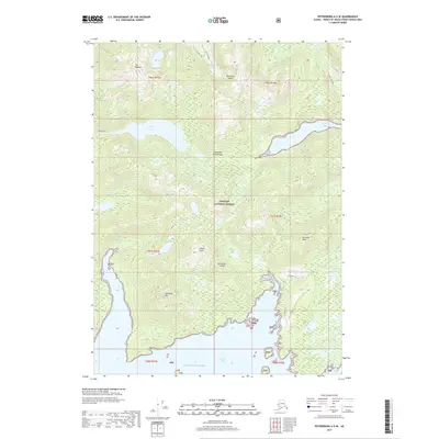
2017 Map of Petersburg A-5 SE
USGS Topo · Published 2017About this map
Kosciusko Island dominates this portion of the Alexander Archipelago, where the dense timber of the Tongass National Forest meets the intricate waterways of the Southeast Alaska coast. The terrain is defined by significant elevations such as Tokeen Peak and Holbrook Mtn, which overlook a network of maritime passages and inlets. Large bodies of fresh and salt water are nearly adjacent here, with Shipley Lake situated just inland from the deep reach of Shipley Bay. The map captures the complex shoreline of Davidson Inlet and Tokeen Bay, reflecting a landscape where the Gulf of Alaska exerts a constant influence on the geography. To the north, the twin summits of The Nipples and the waters of Sutter Lake highlight the interior wilderness of the island.
Find a feature on this map
27 named features on this map. Tap any name to fly to it.
Don’t see what you’re looking for? This feature index may not catch every label — zoom into the map to look around manually.
Map Details
Editions of this 2017 Petersburg A-5 SE Map
This is the sole edition of this map. No revisions or reprints were ever made.
Other maps of this area

1949 · Craig D-4
USGS Topo · 1:63,360

1949 · Petersburg A-5
USGS Topo · 1:63,360

1949 · Petersburg A-4
USGS Topo · 1:63,360

1951 · Craig D-5
USGS Topo · 1:63,360

1951 · Craig D-4
USGS Topo · 1:63,360

1952 · Petersburg
USGS Topo · 1:250,000

1953 · Petersburg A-5
USGS Topo · 1:63,360

1953 · Petersburg A-4
USGS Topo · 1:63,360

1957 · Craig
USGS Topo · 1:250,000

1960 · Petersburg
USGS Topo · 1:250,000