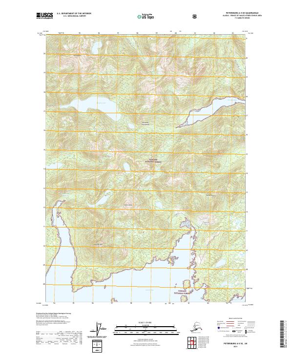
2021 Map of Petersburg A-5 SE
USGS Topo · Published 2021About this map
Alexander Archipelago waters and temperate rainforest dominate this 2021 study of the Tongass National Forest on northern Prince of Wales Island. The landscape is defined by the deep indentations of Davidson Inlet and Tokeen Bay, which reach into a mountainous interior marked by heights like Holbrook Mtn and Tokeen Peak. The distribution of drainage systems, including Sutter Creek and Sutter Lake, reveals the complex hydrology of this coastal environment. Shoreline access remains limited, evidenced by the presence of the Shipley Bay Trl and a few logging-related corridors like Devilfish Spur One near the narrow reaches of Devilfish Bay. This survey captures the region just before recent shifts in forest management, documenting the established trails and remote peaks of the maritime wilderness.
Find a feature on this map
22 named features on this map. Tap any name to fly to it.
Don’t see what you’re looking for? This feature index may not catch every label — zoom into the map to look around manually.
Map Details
Editions of this 2021 Petersburg A-5 SE Map
This is the sole edition of this map. No revisions or reprints were ever made.
Other maps of this area

1949 · Craig D-4
USGS Topo · 1:63,360

1949 · Petersburg A-5
USGS Topo · 1:63,360

1949 · Petersburg A-4
USGS Topo · 1:63,360

1951 · Craig D-5
USGS Topo · 1:63,360

1951 · Craig D-4
USGS Topo · 1:63,360

1952 · Petersburg
USGS Topo · 1:250,000

1953 · Petersburg A-5
USGS Topo · 1:63,360

1953 · Petersburg A-4
USGS Topo · 1:63,360

1957 · Craig
USGS Topo · 1:250,000

1960 · Petersburg
USGS Topo · 1:250,000