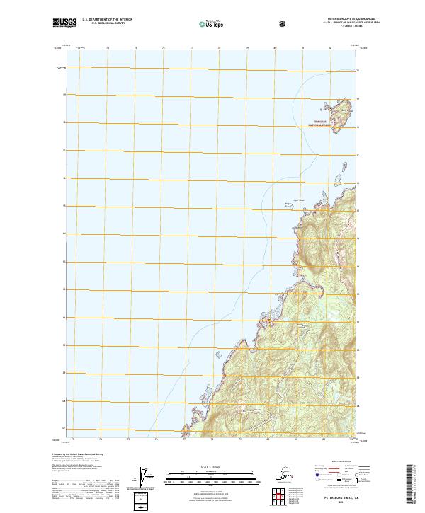
2021 Map of Petersburg A-6 SE
USGS Topo · Published 2021About this map
Kosciusko Island dominates this coastal landscape within the Tongass National Forest, showcasing a complex network of forest service trails and hydrological features in the Alexander Archipelago. The southeastern portion of the island is marked by the distinct Trout Creek Grassland and the intriguing Disappearing Stream, which suggests the underlying karst topography common to this region of Southeast Alaska. Coastal features like Ruins Point and the Finger Islands break the shoreline, while the prominent Two-Tipped Hill provides a primary inland landmark for navigation.
Find a feature on this map
23 named features on this map. Tap any name to fly to it.
Don’t see what you’re looking for? This feature index may not catch every label — zoom into the map to look around manually.
Map Details
Editions of this 2021 Petersburg A-6 SE Map
This is the sole edition of this map. No revisions or reprints were ever made.
Other maps of this area

1948 · Petersburg A-6
USGS Topo · 1:63,360

1949 · Petersburg A-5
USGS Topo · 1:63,360

1951 · Craig D-6
USGS Topo · 1:63,360

1951 · Craig D-5
USGS Topo · 1:63,360

1951 · Petersburg A-6
USGS Topo · 1:63,360

1952 · Petersburg
USGS Topo · 1:250,000

1953 · Petersburg A-5
USGS Topo · 1:63,360

1957 · Craig
USGS Topo · 1:250,000

1960 · Petersburg
USGS Topo · 1:250,000
1995 · Petersburg A-5
USGS Topo · 1:63,360