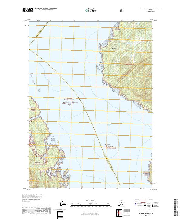
2021 Map of Petersburg B-4 SE
USGS Topo · Published 2021About this map
Clarence Strait serves as the central waterway for this coastal region of southeast Alaska, dividing the land into several significant island masses and administrative zones. On the eastern shore, Wrangell occupies a portion of Zarembo Island, a heavily forested landscape managed as part of the Tongass National Forest. The geography is defined by its maritime access points, such as Macnamara Point and the adjacent Osprey Channel. These waters have historically been critical for navigation and the timber industry, which is reflected in the established Macnamara Point Trl winding through the interior.
Find a feature on this map
14 named features on this map. Tap any name to fly to it.
Don’t see what you’re looking for? This feature index may not catch every label — zoom into the map to look around manually.
Map Details
Editions of this 2021 Petersburg B-4 SE Map
This is the sole edition of this map. No revisions or reprints were ever made.
Other maps of this area

1948 · Petersburg B-3
USGS Topo · 1:63,360

1949 · Petersburg A-3
USGS Topo · 1:63,360

1949 · Petersburg A-4
USGS Topo · 1:63,360

1949 · Petersburg B-4
USGS Topo · 1:63,360

1951 · Petersburg B-4
USGS Topo · 1:63,360

1951 · Petersburg B-3
USGS Topo · 1:63,360

1952 · Petersburg
USGS Topo · 1:250,000

1953 · Petersburg A-4
USGS Topo · 1:63,360

1953 · Petersburg A-3
USGS Topo · 1:63,360

1960 · Petersburg
USGS Topo · 1:250,000