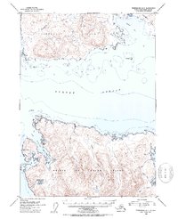
1953 Map of Petersburg B-5
USGS Topo · Published 1954About this map
Prince of Wales Island and Kupreanof Island face one another across the deep, navigable waters of Sumner Strait in this early 1950s survey of the Alexander Archipelago. The settlement of Point Baker serves as a primary coastal anchor, while the nearby Trading Post at Wooden Wheel Cove points to the maritime commerce and fishing economy essential to this part of the Tongass National Forest. The intricate coastline is defined by protected inlets like Port Protection and the curiously named Hole-in-the-Wall. On the northern shore of Prince of Wales Island, a series of drainages including Flicker Creek, Alder Creek, and Red Bay illustrate the steep topographic rise from the water's edge to the interior peaks. Further north, Totem Bay and Little Totem Bay carve into the southern edge of Kupreanof Island, overseen by the landmark at Pt. Barrie.
Find a feature on this map
28 named features on this map. Tap any name to fly to it.
Don’t see what you’re looking for? This feature index may not catch every label — zoom into the map to look around manually.
Map Details
Editions of this 1953 Petersburg B-5 Map
2 editions found
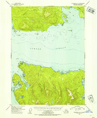
Other maps of this area

1948 · Petersburg A-6
USGS Topo · 1:63,360

1948 · Petersburg C-4
USGS Topo · 1:63,360

1948 · Petersburg B-6
USGS Topo · 1:63,360

1948 · Petersburg C-6
USGS Topo · 1:63,360

1948 · Petersburg C-5
USGS Topo · 1:63,360

1949 · Petersburg B-5
USGS Topo · 1:63,360

1949 · Petersburg A-5
USGS Topo · 1:63,360

1949 · Petersburg A-4
USGS Topo · 1:63,360

1949 · Petersburg B-4
USGS Topo · 1:63,360

1951 · Petersburg B-4
USGS Topo · 1:63,360