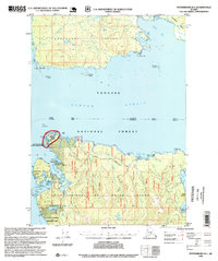
1995 Map of Petersburg B-5
USGS Topo · Published 1999About this map
Sumner Strait separates the rugged northern coast of Prince Of Wales Island from Kupreanof Island in this mid-1990s revision of the Tongass National Forest. The map documents the localized human footprint within the wilderness, specifically around the fishing and timber outposts of Point Baker and Port Protection. While much of the interior is defined by remote drainage systems like Kushneahin Creek and Kushneahin Lake, the coastline reveals a working landscape of Logging Camps and a Log Transfer Facility. These points of industry, connected by the Prince of Wales Road, reflect the mid-century timber economy and the reliance on maritime access. Smaller landmarks like Memorial Beach and the Joe Mace Island State Marine Park highlight the area's significance for local recreation and memorialization amidst the broader forest management zones.
Find a feature on this map
74 named features on this map. Tap any name to fly to it.
Don’t see what you’re looking for? This feature index may not catch every label — zoom into the map to look around manually.
Map Details
Editions of this 1995 Petersburg B-5 Map
This is the sole edition of this map. No revisions or reprints were ever made.
Other maps of this area

1948 · Petersburg A-6
USGS Topo · 1:63,360

1948 · Petersburg C-4
USGS Topo · 1:63,360

1948 · Petersburg B-6
USGS Topo · 1:63,360

1948 · Petersburg C-6
USGS Topo · 1:63,360

1948 · Petersburg C-5
USGS Topo · 1:63,360

1949 · Petersburg B-5
USGS Topo · 1:63,360

1949 · Petersburg A-5
USGS Topo · 1:63,360

1949 · Petersburg A-4
USGS Topo · 1:63,360

1949 · Petersburg B-4
USGS Topo · 1:63,360

1951 · Petersburg B-4
USGS Topo · 1:63,360