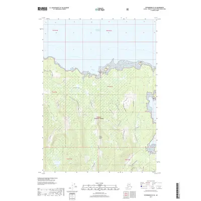
2017 Map of Petersburg B-5 SE
USGS Topo · Published 2017About this map
Tongass National Forest covers the majority of this landscape on Prince of Wales Island, reaching the southern shoreline of the Gulf of Alaska. The coastal geography is defined by deep inlets like Buster Bay and the passage of Summer Strait to the west. Inland, the terrain is marked by significant elevations such as Buster Ridge and an intricate network of waterways including Alder Creek, Strait Creek, and Big Creek. A system of forest roads and loops, including the N Prince of Wales Road and Duck Creek Loop, provides the primary access through this heavily wooded and mountainous island interior. The map illustrates a modern era of forest management and maritime connection in the Alexander Archipelago.
Find a feature on this map
38 named features on this map. Tap any name to fly to it.
Don’t see what you’re looking for? This feature index may not catch every label — zoom into the map to look around manually.
Map Details
Editions of this 2017 Petersburg B-5 SE Map
This is the sole edition of this map. No revisions or reprints were ever made.
Other maps of this area

1949 · Petersburg B-5
USGS Topo · 1:63,360

1949 · Petersburg A-5
USGS Topo · 1:63,360

1949 · Petersburg A-4
USGS Topo · 1:63,360

1949 · Petersburg B-4
USGS Topo · 1:63,360

1951 · Petersburg B-4
USGS Topo · 1:63,360

1952 · Petersburg
USGS Topo · 1:250,000
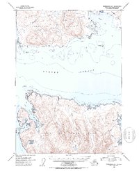
1953 · Petersburg B-5
USGS Topo · 1:63,360

1953 · Petersburg A-5
USGS Topo · 1:63,360

1953 · Petersburg A-4
USGS Topo · 1:63,360

1960 · Petersburg
USGS Topo · 1:250,000