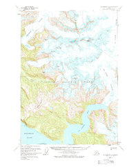
1961 Map of Petersburg D-2
USGS Topo · Published 1984About this map
Patterson Glacier and Le Conte Glacier dominate the northern terrain of this coastal Alaskan landscape, their frozen expanses punctuated by numerous crevasses. The ice-carved topography within the Tongass National Forest is defined by a series of prominent summits, including Church Peak, Saw Peaks, and Thunder Mountain. These peaks overlook the silt-laden waters of the Muddy River and the steep-walled Le Conte Bay.
Find a feature on this map
21 named features on this map. Tap any name to fly to it.
Don’t see what you’re looking for? This feature index may not catch every label — zoom into the map to look around manually.
Map Details
Editions of this 1961 Petersburg D-2 Map
3 editions found

Other maps of this area

1948 · Petersburg C-1
USGS Topo · 1:63,360

1948 · Petersburg C-2
USGS Topo · 1:63,360

1948 · Petersburg C-3
USGS Topo · 1:63,360

1951 · Petersburg C-2
USGS Topo · 1:63,360

1952 · Petersburg
USGS Topo · 1:250,000

1952 · Sumdum
USGS Topo · 1:250,000

1953 · Petersburg C-1
USGS Topo · 1:63,360

1953 · Petersburg C-3
USGS Topo · 1:63,360

1960 · Petersburg
USGS Topo · 1:250,000

1960 · Sumdum A-1
USGS Topo · 1:63,360