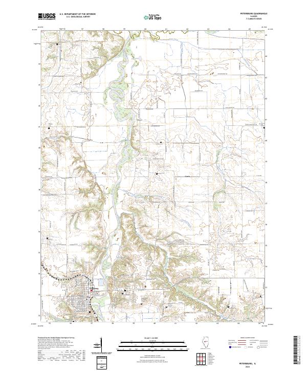
2024 Map of Petersburg
USGS Topo · Published 2024About this map
The Menard County Courthouse anchors the seat of Petersburg, situated along the western banks of the Sangamon River. This 2024 landscape reveals a high concentration of ancestral burial grounds, suggesting deep generational roots in the region. Notable sites include Rose Hill Cem, Saint Peters Cem, and the uniquely numbered Baker Prairie Number 1 Cem and Baker Prairie Number 2 Cem.
Find a feature on this map
70 named features on this map. Tap any name to fly to it.
Don’t see what you’re looking for? This feature index may not catch every label — zoom into the map to look around manually.
Map Details
Editions of this 2024 Petersburg Map
This is the sole edition of this map. No revisions or reprints were ever made.
Other maps of this area

1907 · Springfield
USGS Topo · 1:62,500

1909 · Tallula
USGS Topo · 1:62,500

1930 · Springfield
USGS Topo · 1:62,500

1933 · Petersburg
USGS Topo · 1:62,500

1938 · Petersburg
USGS Topo · 1:62,500

1940 · Tallula
USGS Topo · 1:62,500

1940 · Springfield
USGS Topo · 1:62,500

1948 · Mason City
USGS Topo · 1:62,500

1949 · Mason City
USGS Topo · 1:62,500

1958 · Peoria
USGS Topo · 1:250,000