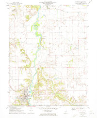
1971 Map of Petersburg
USGS Topo · Published 1973About this map
The Sangamon River meanders prominently through the center of this landscape, its floodplains defined by a complex network of tributaries such as Lattimore Creek, Concord Creek, and Indian Creek. The town of Petersburg serves as the primary hub, situated near the confluence of several early transportation routes including the Gulf Mobile and Ohio and the Chicago and Illinois Midland railroads.
Find a feature on this map
35 named features on this map. Tap any name to fly to it.
Don’t see what you’re looking for? This feature index may not catch every label — zoom into the map to look around manually.
Map Details
Editions of this 1971 Petersburg Map
This is the sole edition of this map. No revisions or reprints were ever made.
Other maps of this area

1907 · Springfield
USGS Topo · 1:62,500

1909 · Tallula
USGS Topo · 1:62,500

1930 · Springfield
USGS Topo · 1:62,500

1933 · Petersburg
USGS Topo · 1:62,500

1938 · Petersburg
USGS Topo · 1:62,500

1940 · Tallula
USGS Topo · 1:62,500

1940 · Springfield
USGS Topo · 1:62,500

1948 · Mason City
USGS Topo · 1:62,500

1949 · Mason City
USGS Topo · 1:62,500

1958 · Peoria
USGS Topo · 1:250,000