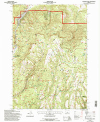
1992 Map of Peterson Point
USGS Topo · Published 1997About this map
Peterson Point rises as a prominent landmark within the Ochogo National Forest, an area defined by complex water systems and high-elevation springs. The landscape is marked by the distinct geologic presence of Broadway Lava and Lava fields, which influence the drainage patterns of Badger Creek and Happy Camp Creek. Resource management for livestock and wildlife is evident through numerous named water sources and small-scale impoundments such as Packsaddle Reservoir, Lowery Reservoir, and Jones Troughs.
Find a feature on this map
41 named features on this map. Tap any name to fly to it.
Don’t see what you’re looking for? This feature index may not catch every label — zoom into the map to look around manually.
Map Details
Editions of this 1992 Peterson Point Map
This is the sole edition of this map. No revisions or reprints were ever made.
Other maps of this area

1926 · Mitchell
USGS Topo · 1:125,000

1932 · Dayville
USGS Topo · 1:125,000

1936 · Dayville
USGS Topo · 1:125,000

1953 · Richmond
USGS Topo · 1:62,500

1955 · Bend
USGS Topo · 1:250,000

1955 · Canyon City
USGS Topo · 1:250,000

1957 · Bend
USGS Topo · 1:250,000

1958 · Bend
USGS Topo · 1:250,000

1959 · Canyon City
USGS Topo · 1:250,000

1965 · Williams Prairie
USGS Topo · 1:24,000