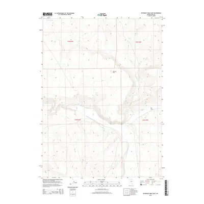
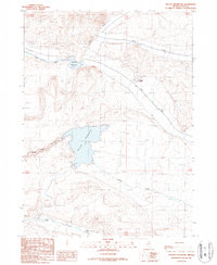
2014 Map of Peterson Table East
USGS Topo · Published 2014About this map
The South Fork Owyhee River carves a deep path through this high desert terrain in Elko County, defining a landscape shaped by hydrology and seasonal grazing. The flat elevation of Peterson Table stands as a prominent topographical landmark north of the river, while smaller water features like Garat Spring and the Garat Reservoir indicate the vital role of water management in this arid region. The network of drainage, including Sheep Cr, Spring Cr, and Circle Cr, highlights the natural runoff patterns feeding the Owyhee basin. This area, largely defined by the Public Land Survey System boundaries of T46N and T45N, reflects a vast, open landscape where terrain features such as Rye Grass serve as local navigation points for ranchers and travelers in the Nevada interior.
Find a feature on this map
14 named features on this map. Tap any name to fly to it.
Don’t see what you’re looking for? This feature index may not catch every label — zoom into the map to look around manually.
Map Details
Editions of this 2014 Peterson Table East Map
This is the sole edition of this map. No revisions or reprints were ever made.
Other maps of this area

1955 · McDermitt
USGS Topo · 1:250,000

1959 · McDermitt
USGS Topo · 1:250,000

1964 · Hat Peak
USGS Topo · 1:62,500

1964 · Wilson Reservoir
USGS Topo · 1:62,500
1974 · Twelvemile Flat SE
USGS Topo · 1:24,000

1974 · Desert Ranch
USGS Topo · 1:24,000
1977 · State Line Camp
USGS Topo · 1:24,000

1982 · Bull Run Mts
USGS Topo · 1:100,000
1987 · Fourmile Butte
USGS Topo · 1:24,000
1987 · Wilson Reservoir
USGS Topo · 1:24,000