
2020 Map of Petes Cove
USGS Topo · Published 2020About this map
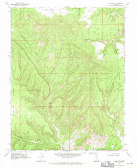
Kaiparowits Plateau dominates the northern reaches of this Kane County landscape, where the high tableland gives way to an intricate system of drainages and level benches. The topographic layout is defined by the erosion of the plateau, carving out deep natural features like Escalante Canyon and Paradise Canyon to the southwest. This area serves as a study in vertical geography, where named flatlands such as Paradise Bench, Fourmile Bench, and Window Sash Bench represent distinct geological steps between the high plateau and the lower canyons. To the east, Petes Cove and Dry Wash mark significant hydrological features in a region primarily accessed via the sparse network of Co RD routes. The map illustrates a largely unpopulated wilderness, preserved in its geological state as of the early 21st century.
Find a feature on this map
17 named features on this map. Tap any name to fly to it.
Don’t see what you’re looking for? This feature index may not catch every label — zoom into the map to look around manually.
Map Details
Editions of this 2020 Petes Cove Map
This is the sole edition of this map. No revisions or reprints were ever made.
Other maps of this area

1886 · Escalante
USGS Topo · 1:250,000

1922 · Upper Last Chance
USGS Topo · 1:63,360

1922 · Rees Canyon
USGS Topo · 1:63,360

1956 · Escalante
USGS Topo · 1:250,000

1960 · Escalante
USGS Topo · 1:250,000

1964 · Seep Flat
USGS Topo · 1:24,000

1964 · Death Ridge
USGS Topo · 1:24,000

1964 · Carcass Canyon
USGS Topo · 1:24,000

1968 · Fourmile Bench
USGS Topo · 1:24,000
1968 · Petes Cove
USGS Topo · 1:24,000