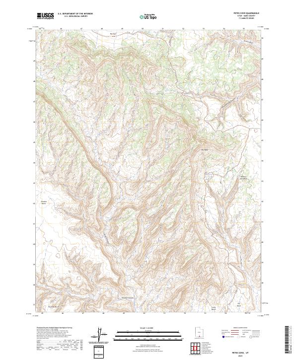
2023 Map of Petes Cove
USGS Topo · Published 2023About this map
Petes Cove and the surrounding high desert benches define this portion of Kane County, where complex drainage systems like Dry Wash and Last Chance Creek carve through the plateau. The landscape is characterized by a series of distinct natural elevations, including Window Sash Bench, Fourmile Bench, and Paradise Bench, which provide clear boundaries between the deep-cut canyon systems. The presence of the Smoky Mountain Road Trl and various county roads like Co RD suggests a network of primitive access routes used for land management and exploration. Transitioning between the expansive Big Sage flats in the north and the intricate network of Escalante Canyon and Paradise Canyon to the south, this map documents the modern topographic character of a remote and largely undeveloped interior.
Find a feature on this map
19 named features on this map. Tap any name to fly to it.
Don’t see what you’re looking for? This feature index may not catch every label — zoom into the map to look around manually.
Map Details
Editions of this 2023 Petes Cove Map
This is the sole edition of this map. No revisions or reprints were ever made.
Other maps of this area

1886 · Escalante
USGS Topo · 1:250,000

1922 · Upper Last Chance
USGS Topo · 1:63,360

1922 · Rees Canyon
USGS Topo · 1:63,360

1956 · Escalante
USGS Topo · 1:250,000

1960 · Escalante
USGS Topo · 1:250,000

1964 · Seep Flat
USGS Topo · 1:24,000

1964 · Death Ridge
USGS Topo · 1:24,000

1964 · Carcass Canyon
USGS Topo · 1:24,000

1968 · Fourmile Bench
USGS Topo · 1:24,000
1968 · Petes Cove
USGS Topo · 1:24,000