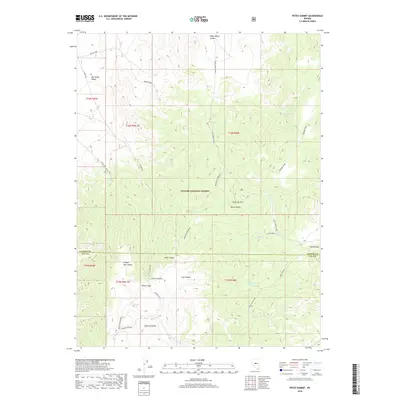
2018 Map of Petes Summit
USGS Topo · Published 2018About this map
The Toquima Range dominates this high-altitude landscape where the boundaries of Lander and Nye Counties meet. This area, largely within the Toiyabe National Forest, is defined by a network of seasonal springs and deep canyons that supported early mining and range activities. The presence of the Bronco Mine near Big Smoky Valley indicates the region's historical mineral interests, while the Stoneberger Basin provides a natural catchment in the southern portion of the sheet. Remote access is facilitated by the Petes Summit Road and various rugged tracks like the Muggs Motortrail, which navigate the steep terrain between Petes Summit and Clipper Gap. Named water sources such as Sage Hen Spring and Turquoise Spring serve as vital landmarks in this arid environment.
Find a feature on this map
36 named features on this map. Tap any name to fly to it.
Don’t see what you’re looking for? This feature index may not catch every label — zoom into the map to look around manually.
Map Details
Editions of this 2018 Petes Summit Map
This is the sole edition of this map. No revisions or reprints were ever made.
Other maps of this area

1926 · Roberts Mountains
USGS Topo · 1:250,000

1929 · Roberts Mountains
USGS Topo · 1:250,000

1955 · Millett
USGS Topo · 1:250,000

1959 · Millett
USGS Topo · 1:250,000

1960 · Hickison Summit
USGS Topo · 1:62,500

1960 · Spencer Hot Springs
USGS Topo · 1:62,500

1960 · Dianas Punch Bowl
USGS Topo · 1:62,500

1960 · Wildcat Peak
USGS Topo · 1:62,500

1978 · Summit Mountain
USGS Topo · 1:100,000
1989 · Dianas Punch Bowl
USGS Topo · 1:24,000