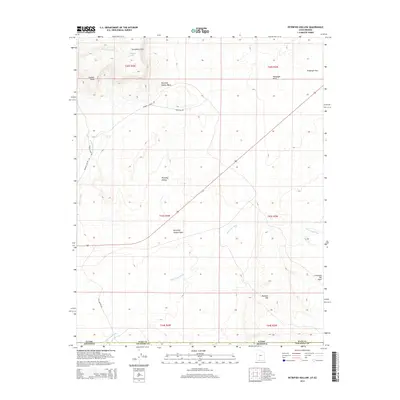
2014 Map of Petrified Hollow
USGS Topo · Published 2014About this map
The Vermilion Cliffs dominate the northern landscape of this borderland region where the Utah Arizona state line divides the high desert. This 2014 survey documents a territory defined by intricate drainage systems and high plateaus, including Buckskin Mtn and Seaman Point. The topography is marked by notable depressions like Limestone Pot Holes and the geological namesake of Petrified Hollow. Water movement is recorded through the intermittent flows of Seaman Wash, Petrified Hollow Wash, and White Sage Wash, which carve paths through the arid terrain. Access across this remote stretch of Kane and Coconino Counties is maintained by historic routes such as Old Arizona Rd, alongside Seaman Canyon Rd and Waterline Rd, showing how modern infrastructure follows the natural contours of the canyon lands.
Find a feature on this map
20 named features on this map. Tap any name to fly to it.
Don’t see what you’re looking for? This feature index may not catch every label — zoom into the map to look around manually.
Map Details
Editions of this 2014 Petrified Hollow Map
This is the sole edition of this map. No revisions or reprints were ever made.
Other maps of this area

1886 · Kanab
USGS Topo · 1:250,000

1886 · Kaibab
USGS Topo · 1:250,000

1953 · Cedar City
USGS Topo · 1:250,000

1953 · Grand Canyon
USGS Topo · 1:250,000

1954 · Buckskin Gulch NW
USGS Topo · 1:24,000

1954 · Buckskin Gulch NE
USGS Topo · 1:24,000

1954 · Buckskin Gulch SE
USGS Topo · 1:24,000

1954 · Buckskin Gulch SW
USGS Topo · 1:24,000

1954 · Johnson SE
USGS Topo · 1:24,000
1954 · House Rock Spring NE
USGS Topo · 1:24,000