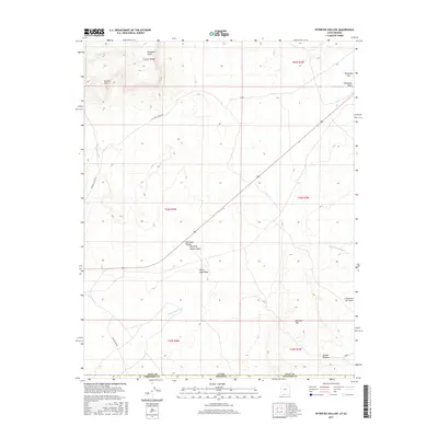
2017 Map of Petrified Hollow
USGS Topo · Published 2017About this map
The Vermilion Cliffs and the northern reaches of the Kaibab Plateau dominate this high-desert landscape along the border of Utah and Arizona. This survey focuses on a remote section of the Paria Plateau region, where drainage patterns are defined by several prominent dry washes, including Seaman Wash, Telegraph Wash, and White Sage Wash. The topography is marked by significant elevation shifts, rising from the broad Telegraph Flat toward the heights of Buckskin Mtn and the distinct overlook at Seaman Point.
Find a feature on this map
21 named features on this map. Tap any name to fly to it.
Don’t see what you’re looking for? This feature index may not catch every label — zoom into the map to look around manually.
Map Details
Editions of this 2017 Petrified Hollow Map
This is the sole edition of this map. No revisions or reprints were ever made.
Other maps of this area

1886 · Kanab
USGS Topo · 1:250,000

1886 · Kaibab
USGS Topo · 1:250,000

1953 · Cedar City
USGS Topo · 1:250,000

1953 · Grand Canyon
USGS Topo · 1:250,000

1954 · Buckskin Gulch NW
USGS Topo · 1:24,000

1954 · Buckskin Gulch NE
USGS Topo · 1:24,000

1954 · Buckskin Gulch SE
USGS Topo · 1:24,000

1954 · Buckskin Gulch SW
USGS Topo · 1:24,000

1954 · Johnson SE
USGS Topo · 1:24,000
1954 · House Rock Spring NE
USGS Topo · 1:24,000