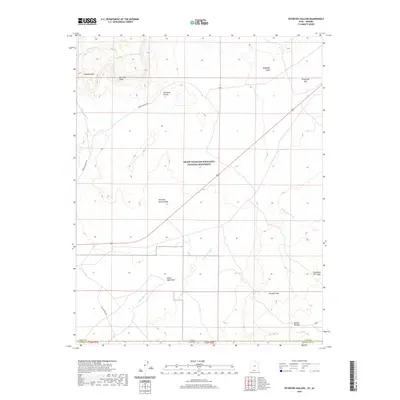
2020 Map of Petrified Hollow
USGS Topo · Published 2020About this map
Vermilion Cliffs and the northern reaches of the Kaibab Plateau dominate this landscape along the border between Utah and Arizona. This 2020 survey illustrates a complex system of drainage and erosion, where White Sage Wash and Petrified Hollow Wash cut through the high desert floor. Much of the northern half of the quadrangle is preserved within the Grand Staircase-Escalante National Monument, reflecting a region primarily defined by its geology and conservation status rather than intensive settlement.
Find a feature on this map
16 named features on this map. Tap any name to fly to it.
Don’t see what you’re looking for? This feature index may not catch every label — zoom into the map to look around manually.
Map Details
Editions of this 2020 Petrified Hollow Map
This is the sole edition of this map. No revisions or reprints were ever made.
Other maps of this area

1886 · Kanab
USGS Topo · 1:250,000

1886 · Kaibab
USGS Topo · 1:250,000

1953 · Cedar City
USGS Topo · 1:250,000

1953 · Grand Canyon
USGS Topo · 1:250,000

1954 · Buckskin Gulch NW
USGS Topo · 1:24,000

1954 · Buckskin Gulch NE
USGS Topo · 1:24,000

1954 · Buckskin Gulch SE
USGS Topo · 1:24,000

1954 · Buckskin Gulch SW
USGS Topo · 1:24,000

1954 · Johnson SE
USGS Topo · 1:24,000
1954 · House Rock Spring NE
USGS Topo · 1:24,000