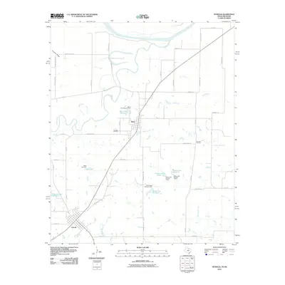
2010 Map of Petrolia
USGS Topo · Published 2010About this map
Petrolia and Byers anchor this northern Texas landscape where the Wichita River converges toward the Red River valley. The map reveals a highly developed system of local water management, characterized by a series of numbered reservoirs including Parker Lake Number 1, Parker Lake Number 2, and Parker Lake Number 3, as well as the Byers City Reservoir. These features, along with Mayo Lake and Petrolia Lake Number 1, suggest a landscape historically adapted to support the local agricultural and municipal needs of Clay County.
Find a feature on this map
50 named features on this map. Tap any name to fly to it.
Don’t see what you’re looking for? This feature index may not catch every label — zoom into the map to look around manually.
Map Details
Editions of this 2010 Petrolia Map
This is the sole edition of this map. No revisions or reprints were ever made.
Other maps of this area

1954 · Wichita Falls
USGS Topo · 1:250,000

1955 · Lawton
USGS Topo · 1:250,000

1956 · Henrietta
USGS Topo · 1:62,500

1957 · Hastings
USGS Topo · 1:62,500

1957 · Randlett
USGS Topo · 1:62,500

1957 · Wichita Falls East
USGS Topo · 1:62,500

1958 · Wichita Falls
USGS Topo · 1:250,000
1972 · Dean
USGS Topo · 1:24,000
1972 · Charlie
USGS Topo · 1:24,000

1984 · Hooper
USGS Topo · 1:24,000