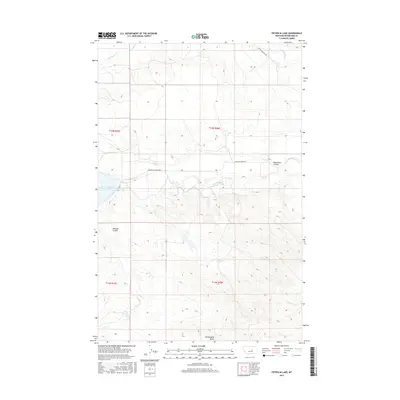
2017 Map of Petrolia Lake
USGS Topo · Published 2017About this map
Petrolia Lake and the winding drainage of Flatwillow Cr characterize this remote landscape in Petroleum County. The map documents a sparsely populated ranching and badlands region where the topography is defined by significant erosion features such as Racehorse Coulee and Johnson Coulee. The primary infrastructure is the Petrolia Bench Rd, which traverses the high ground above the creek valleys.
Find a feature on this map
13 named features on this map. Tap any name to fly to it.
Don’t see what you’re looking for? This feature index may not catch every label — zoom into the map to look around manually.
Map Details
Editions of this 2017 Petrolia Lake Map
This is the sole edition of this map. No revisions or reprints were ever made.
Other maps of this area

1954 · Roundup
USGS Topo · 1:250,000

1954 · Lewistown
USGS Topo · 1:250,000

1958 · Roundup
USGS Topo · 1:250,000

1959 · Lewistown
USGS Topo · 1:250,000

1963 · Kelley
USGS Topo · 1:24,000

1963 · Petrolia Lake
USGS Topo · 1:24,000
1963 · Breed Spring
USGS Topo · 1:24,000
1963 · Mud Spring
USGS Topo · 1:24,000
1986 · Cat Creek
USGS Topo · 1:24,000

1986 · Ingals Dam
USGS Topo · 1:24,000