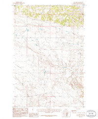
1986 Map of Cat Creek
USGS Topo · Published 1986About this map
Oil Field operations define the landscape of this Petroleum County region as it appeared in the late 1970s and mid-1980s. The terrain is marked by a complex network of ephemeral drainages, including Long Coulee and Jackson Coulee, which carve through the high plains toward the namesake Cat Creek drainage. The settlement of Cat Creek itself serves as a focal point for local activity, while Fall Ranch indicates the continued importance of ranching in this sparsely populated stretch of Montana. Industrial markers like the Gravel Pit and numerous resource extraction sites illustrate the economic intersection of energy production and traditional land use during this period of geological survey.
Find a feature on this map
10 named features on this map. Tap any name to fly to it.
Don’t see what you’re looking for? This feature index may not catch every label — zoom into the map to look around manually.
Map Details
Editions of this 1986 Cat Creek Map
2 editions found
Other maps of this area

1954 · Jordan
USGS Topo · 1:250,000

1954 · Forsyth
USGS Topo · 1:250,000

1954 · Roundup
USGS Topo · 1:250,000

1954 · Lewistown
USGS Topo · 1:250,000

1956 · Jordan
USGS Topo · 1:250,000

1957 · Forsyth
USGS Topo · 1:250,000

1958 · Jordan
USGS Topo · 1:250,000

1958 · Roundup
USGS Topo · 1:250,000

1958 · Forsyth
USGS Topo · 1:250,000

1959 · Lewistown
USGS Topo · 1:250,000