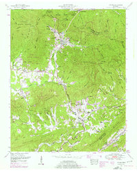
1952 Map of Petros
USGS Topo · Published 1976About this map
Petros serves as the focal point of this 1952 landscape, dominated by the imposing presence of the Brushy Mountain State Prison and its associated Brushy Mountain State Prison Cemetery. The topography is defined by the steep rises of Little Brushy Mountain and Frozen Head Mountain, much of which is contained within the Morgan State Forest. The settlement pattern follows the narrow valleys of Crooked Fork and the Emory River, where mining operations and rail access via the Southern railroad shaped local life.
Find a feature on this map
80 named features on this map. Tap any name to fly to it.
Don’t see what you’re looking for? This feature index may not catch every label — zoom into the map to look around manually.
Map Details
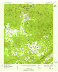
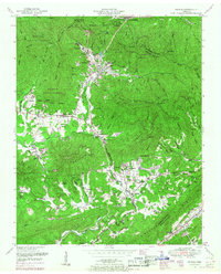
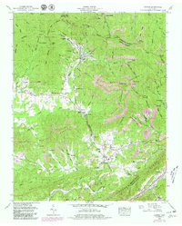
Editions of this 1952 Petros Map
4 editions found
Other maps of this area

1887 · Kingston
USGS Topo · 1:125,000

1891 · Kingston
USGS Topo · 1:125,000

1893 · Briceville
USGS Topo · 1:125,000

1893 · Kingston
USGS Topo · 1:125,000

1895 · Wartburg
USGS Topo · 1:125,000

1895 · Loudon
USGS Topo · 1:125,000

1895 · Briceville
USGS Topo · 1:125,000

1896 · Wartburg
USGS Topo · 1:125,000

1896 · Briceville
USGS Topo · 1:125,000

1935 · Gobey
USGS Topo · 1:24,000