1952 Map of Petros
USGS Topo · Published 1980About this map
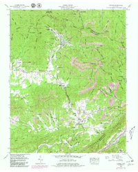
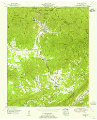
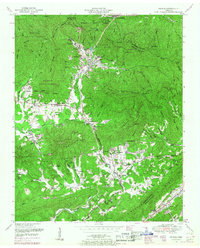
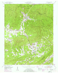
The Brushy Mountain State Prison dominates the upper reaches of Stockstill Creek, marking a landscape where institutional presence and heavy industry meet the steep slopes of Big Brushy Mountain. This mid-century survey captures the region's extraction-based economy, showing extensive Strip Mines and the Southern Railway lines that moved coal and timber through the tight valleys of Sawmill Valley and past the community of Petros.
Find a feature on this map
94 named features on this map. Tap any name to fly to it.
Don’t see what you’re looking for? This feature index may not catch every label — zoom into the map to look around manually.
Map Details
Editions of this 1952 Petros Map
4 editions found
Other maps of this area

1887 · Kingston
USGS Topo · 1:125,000

1891 · Kingston
USGS Topo · 1:125,000

1893 · Briceville
USGS Topo · 1:125,000

1893 · Kingston
USGS Topo · 1:125,000

1895 · Wartburg
USGS Topo · 1:125,000

1895 · Loudon
USGS Topo · 1:125,000

1895 · Briceville
USGS Topo · 1:125,000

1896 · Wartburg
USGS Topo · 1:125,000

1896 · Briceville
USGS Topo · 1:125,000

1935 · Gobey
USGS Topo · 1:24,000