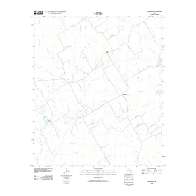
2010 Map of Petteway
USGS Topo · Published 2010About this map
White Rock and Petteway anchor this rural Robertson County landscape, characterized by a complex network of named watercourses and local ranch roads. The terrain is defined by the drainage of several significant creeks including Big Sandy Creek, Claybank Creek, and Hurricane Creek, which flow through the undulating countryside toward larger basins. In the west, Abraham Lake and its corresponding Abraham Lake Dam represent a managed hydraulic environment, while the eastern edge is marked by the presence of the Twin Oak Reservoir.
Find a feature on this map
44 named features on this map. Tap any name to fly to it.
Don’t see what you’re looking for? This feature index may not catch every label — zoom into the map to look around manually.
Map Details
Editions of this 2010 Petteway Map
This is the sole edition of this map. No revisions or reprints were ever made.
Other maps of this area

1927 · Marquez
USGS Topo · 1:62,500

1930 · Marquez
USGS Topo · 1:62,500

1954 · Waco
USGS Topo · 1:250,000

1955 · Waco
USGS Topo · 1:250,000

1962 · Hammond
USGS Topo · 1:24,000

1962 · Bremond
USGS Topo · 1:24,000

1962 · Petteway
USGS Topo · 1:24,000
1962 · Owensville
USGS Topo · 1:24,000
1965 · Franklin
USGS Topo · 1:24,000
1965 · Bald Prairie
USGS Topo · 1:24,000