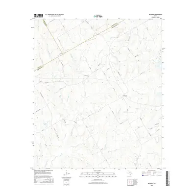
2016 Map of Petteway
USGS Topo · Published 2016About this map
Petteway stands at the heart of this East Texas landscape, where the borders of Robertson, Falls, and Limestone counties converge. The terrain is defined by a dense network of seasonal and permanent watercourses, including the westward-flowing Big Sandy Creek and the meandering Walnut Creek. These waterways, along with Gnats Creek and Mill Creek, historically dictated the patterns of settlement and agriculture in the region.
Find a feature on this map
62 named features on this map. Tap any name to fly to it.
Don’t see what you’re looking for? This feature index may not catch every label — zoom into the map to look around manually.
Map Details
Editions of this 2016 Petteway Map
This is the sole edition of this map. No revisions or reprints were ever made.
Other maps of this area

1927 · Marquez
USGS Topo · 1:62,500

1930 · Marquez
USGS Topo · 1:62,500

1954 · Waco
USGS Topo · 1:250,000

1955 · Waco
USGS Topo · 1:250,000

1962 · Hammond
USGS Topo · 1:24,000

1962 · Bremond
USGS Topo · 1:24,000

1962 · Petteway
USGS Topo · 1:24,000
1962 · Owensville
USGS Topo · 1:24,000
1965 · Franklin
USGS Topo · 1:24,000
1965 · Bald Prairie
USGS Topo · 1:24,000