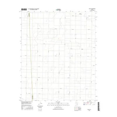
2016 Map of Pettit
USGS Topo · Published 2016About this map
Pettit serves as the primary focal point of this 2016 survey, situated on the high plains of the Texas Panhandle. The landscape is defined by an expansive, grid-like network of rural roads with distinctive international naming conventions, including Mexico Rd, India Rd, Brazil Rd, and England Rd. This systematic arrangement of section lines reflects the orderly agricultural development of the South Plains, where large-scale farming and ranching dominate the terrain.
Find a feature on this map
29 named features on this map. Tap any name to fly to it.
Don’t see what you’re looking for? This feature index may not catch every label — zoom into the map to look around manually.
Map Details
Editions of this 2016 Pettit Map
This is the sole edition of this map. No revisions or reprints were ever made.
Other maps of this area

1954 · Brownfield
USGS Topo · 1:250,000

1958 · Brownfield
USGS Topo · 1:250,000

1962 · Brownfield
USGS Topo · 1:250,000

1964 · Oklahoma Flat
USGS Topo · 1:24,000

1964 · Pep
USGS Topo · 1:24,000

1965 · Levelland West
USGS Topo · 1:24,000

1965 · Hester Ranch
USGS Topo · 1:24,000

1965 · Pettit
USGS Topo · 1:24,000

1965 · Whiteface
USGS Topo · 1:24,000

1970 · Whiteface SW
USGS Topo · 1:24,000