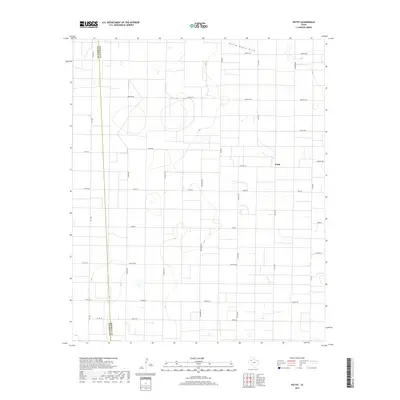
2019 Map of Pettit
USGS Topo · Published 2019About this map
Pettit sits at the heart of this High Plains landscape, where the rectangular grid of West Texas agricultural roads dominates the terrain. The northern edge is marked by the subtle depression of Yellow House Draw, a significant regional drainage feature that winds through the semi-arid environment. The boundary between Cochran Co and Hockley Co runs vertically through the western portion of the map, illustrating how administrative lines bisect the wide-open ranch and farm lands. Roads carry an international flair in their naming conventions, with routes like Mexico Rd, Kenya Rd, Greece, and England Rd defining the local travel network alongside the north-south corridors of Topeka Ave and Santa Fe Rd. This 2019 survey documents the enduring spatial arrangement of a region defined by commercial agriculture and rural connectivity.
Find a feature on this map
28 named features on this map. Tap any name to fly to it.
Don’t see what you’re looking for? This feature index may not catch every label — zoom into the map to look around manually.
Map Details
Editions of this 2019 Pettit Map
This is the sole edition of this map. No revisions or reprints were ever made.
Other maps of this area

1954 · Brownfield
USGS Topo · 1:250,000

1958 · Brownfield
USGS Topo · 1:250,000

1962 · Brownfield
USGS Topo · 1:250,000

1964 · Oklahoma Flat
USGS Topo · 1:24,000

1964 · Pep
USGS Topo · 1:24,000

1965 · Levelland West
USGS Topo · 1:24,000

1965 · Hester Ranch
USGS Topo · 1:24,000

1965 · Pettit
USGS Topo · 1:24,000

1965 · Whiteface
USGS Topo · 1:24,000

1970 · Whiteface SW
USGS Topo · 1:24,000