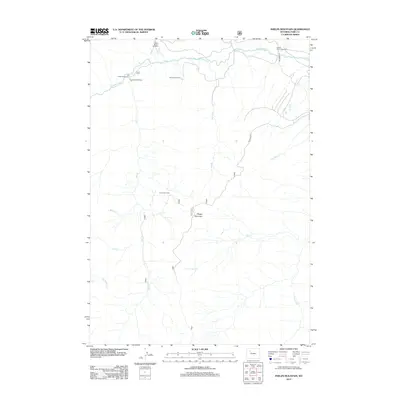
2012 Map of Phelps Mountain
USGS Topo · Published 2012About this map
The Greybull River cuts across the northern reaches of this Wyoming landscape, providing the lifeblood for high-country livestock operations like Palette Ranch Number 1, Palette Ranch Number 2, and the Homestead Ranch. Located in a transition between river bottoms and high peaks, the area is defined by a series of south-to-north drainages including Jack Cr, Willow Cr, and Francs Fork. Outdoor recreation and land management are centered near the Jack Creek Campground and Jack Creek Trailhead, while more remote reaches are accessed via Pitchfork Rd and Philips Mt Rd. The terrain rises significantly toward the south, culminating at Phelps Mountain, where Jack Creek Cabin serves as a lone reference point in the higher elevations. This 2012 survey illustrates the enduring nature of the large ranching estates and federal land use in Park County.
Find a feature on this map
19 named features on this map. Tap any name to fly to it.
Don’t see what you’re looking for? This feature index may not catch every label — zoom into the map to look around manually.
Map Details
Editions of this 2012 Phelps Mountain Map
This is the sole edition of this map. No revisions or reprints were ever made.
Other maps of this area

1904 · Kirwin
USGS Topo · 1:125,000

1906 · Kirwin
USGS Topo · 1:125,000

1955 · Cody
USGS Topo · 1:250,000

1955 · Thermopolis
USGS Topo · 1:250,000

1957 · Irish Rock
USGS Topo · 1:62,500

1957 · Sunshine Reservoir
USGS Topo · 1:62,500

1958 · Cody
USGS Topo · 1:250,000

1958 · Thermopolis
USGS Topo · 1:250,000

1962 · Thermopolis
USGS Topo · 1:250,000

1962 · Cody
USGS Topo · 1:250,000