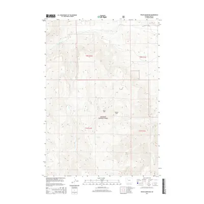
2015 Map of Phelps Mountain
USGS Topo · Published 2015About this map
Phelps Mtn stands as the central landmark in this high-elevation portion of the Shoshone National Forest, where the terrain is defined by the sharp ridges of the Absaroka Range. The Greybull River cuts across the northern edge of the sheet, fed by a complex drainage network including Piney Cr, Willow Cr, and Jack Cr. Human activity in this wilderness area is centered on resource access and high-altitude navigation, evidenced by the Four Bear Oil Field Rd in the northeast and the winding Phillips Mt Rd that climbs toward the mountain peaks. The map reveals the intricate water system of the eastern Absarokas, tracing numerous smaller seasonal and perennial streams such as Kay Cr, Trish Cr, and Frances Fork as they navigate the steep descent from the timberline.
Find a feature on this map
19 named features on this map. Tap any name to fly to it.
Don’t see what you’re looking for? This feature index may not catch every label — zoom into the map to look around manually.
Map Details
Editions of this 2015 Phelps Mountain Map
This is the sole edition of this map. No revisions or reprints were ever made.
Other maps of this area

1904 · Kirwin
USGS Topo · 1:125,000

1906 · Kirwin
USGS Topo · 1:125,000

1955 · Cody
USGS Topo · 1:250,000

1955 · Thermopolis
USGS Topo · 1:250,000

1957 · Irish Rock
USGS Topo · 1:62,500

1957 · Sunshine Reservoir
USGS Topo · 1:62,500

1958 · Cody
USGS Topo · 1:250,000

1958 · Thermopolis
USGS Topo · 1:250,000

1962 · Thermopolis
USGS Topo · 1:250,000

1962 · Cody
USGS Topo · 1:250,000