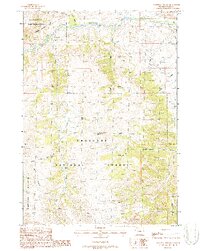
1987 Map of Phelps Mountain
USGS Topo · Published 1988About this map
The Shoshone National Forest landscape in Wyoming is defined by the high-elevation drainage systems of the Greybull River. This 1980s survey captures a transition point between preserved wilderness and resource extraction, where the Washakie Wilderness border meets active Oil Field operations in the northeastern portion of the quadrangle. High-country access is documented through the Haymaker Trail and various unnamed paths that follow the contours of Phelps Mountain.
Find a feature on this map
18 named features on this map. Tap any name to fly to it.
Don’t see what you’re looking for? This feature index may not catch every label — zoom into the map to look around manually.
Map Details
Editions of this 1987 Phelps Mountain Map
This is the sole edition of this map. No revisions or reprints were ever made.
Other maps of this area

1904 · Kirwin
USGS Topo · 1:125,000

1906 · Kirwin
USGS Topo · 1:125,000

1955 · Cody
USGS Topo · 1:250,000

1955 · Thermopolis
USGS Topo · 1:250,000

1957 · Irish Rock
USGS Topo · 1:62,500

1957 · Sunshine Reservoir
USGS Topo · 1:62,500

1958 · Cody
USGS Topo · 1:250,000

1958 · Thermopolis
USGS Topo · 1:250,000

1962 · Thermopolis
USGS Topo · 1:250,000

1962 · Cody
USGS Topo · 1:250,000