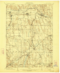
1902 Map of Phelps
USGS Topo · Published 1923About this map
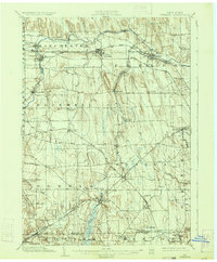
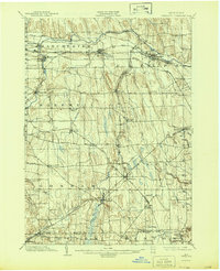
Canandaigua Outlet carves a winding path through the northern half of this landscape, anchoring a series of established rail towns at the turn of the century. The transportation network is remarkably dense, featuring the Lehigh Valley R.R. and the New York Central and Hudson River R.R. (Auburn Division) which connect hubs like Clifton Springs and Shortsville. Near the eastern margin, the N.Y. Agricultural Station marks an early center for scientific study along Preemption Road. The map reveals the rural infrastructure of Ontario Co. and Yates Co., from the Gypsum deposits in the north to small farming hamlets such as Ennerdale (Beulah), Reed Corners, and Seneca Castle. The terrain is characterized by the distinct north-south glacial ridges that dictate the flow of Flint Creek and Fall Brook, influencing the placement of the many small-scale settlements and crossroads across this agricultural heartland.
Find a feature on this map
48 named features on this map. Tap any name to fly to it.
Don’t see what you’re looking for? This feature index may not catch every label — zoom into the map to look around manually.
Map Details
Editions of this 1902 Phelps Map
7 editions found
Other maps of this area

1899 · Palmyra
USGS Topo · 1:62,500

1900 · Macedon
USGS Topo · 1:62,500

1900 · Naples
USGS Topo · 1:62,500

1900 · Canandaigua
USGS Topo · 1:62,500

1902 · Geneva
USGS Topo · 1:62,500

1902 · Clyde
USGS Topo · 1:62,500

1902 · Phelps
USGS Topo · 1:62,500

1902 · Ovid
USGS Topo · 1:62,500

1902 · Palmyra
USGS Topo · 1:62,500

1903 · Naples
USGS Topo · 1:62,500