
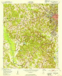
1950 Map of Phenix City
USGS Topo · Published 1954About this map
Phenix City and its southern neighbor Girard dominate the northeastern corner of this survey, illustrating the urban landscape of eastern Alabama just before the mid-century. This region, where the Lee Co and Russell Co lines meet, shows a dense network of local institutions such as Mother Mary Mission, Central High Sch, and Idle Hour Park. The city's post-war infrastructure is evident through the presence of Martin Stadium and the Phenix City Memorial Hospital.
Find a feature on this map
39 named features on this map. Tap any name to fly to it.
Don’t see what you’re looking for? This feature index may not catch every label — zoom into the map to look around manually.
Map Details
Editions of this 1950 Phenix City Map
2 editions found
Other maps of this area

1907 · Talbotton
USGS Topo · 1:125,000

1907 · Opelika
USGS Topo · 1:125,000

1908 · Columbus
USGS Topo · 1:62,500

1909 · Opelika
USGS Topo · 1:125,000

1914 · Seale
USGS Topo · 1:62,500

1929 · Columbus
USGS Topo · 1:48,000

1947 · Columbus
USGS Topo · 1:62,500

1949 · Fort Mitchell
USGS Topo · 1:24,000

1949 · Columbus
USGS Topo · 1:24,000

1950 · Fort Benning
USGS Topo · 1:24,000