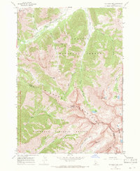
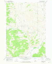
1967 Map of Phi Kappa Mtn
USGS Topo · Published 1971About this map
Phi Kappa Mines and several smaller Mines and Prospects dot the high elevations of the Pioneer Mountains on the boundary of Custer and Blaine Counties. This high-altitude landscape is defined by its drainage systems and glacial features, where Big Fall Creek, Summit Creek, and Phi Kappa Creek carve through the deep valleys of the Challis National Forest. The map documents a primitive transportation network consisting of a Jeep Trail following the creek beds and numerous Pack Trails that provided access to remote peaks like Handwerk Peak and the distinctive formation known as The Devils Bedstead. High-mountain basins hold a series of alpine waters, including Washington Lake, Boulder Lake, and Kane Lake. The transition between the Challis and Sawtooth National Forest is clearly delineated across Duncan Ridge, reflecting the mid-century management of these public lands.
Find a feature on this map
32 named features on this map. Tap any name to fly to it.
Don’t see what you’re looking for? This feature index may not catch every label — zoom into the map to look around manually.
Map Details
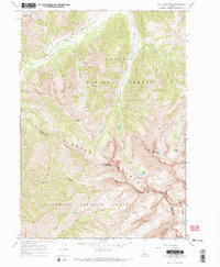
Editions of this 1967 Phi Kappa Mtn Map
2 editions found
Other maps of this area

1895 · Hailey
USGS Topo · 1:125,000

1897 · Hailey
USGS Topo · 1:125,000

1955 · Hailey
USGS Topo · 1:250,000

1959 · Hailey
USGS Topo · 1:250,000

1962 · Hailey
USGS Topo · 1:250,000
1967 · Harry Canyon
USGS Topo · 1:24,000
1967 · Meridian Peak
USGS Topo · 1:24,000

1967 · Rock Roll Canyon
USGS Topo · 1:24,000
1967 · Herd Peak
USGS Topo · 1:24,000

1967 · Sun Valley
USGS Topo · 1:24,000