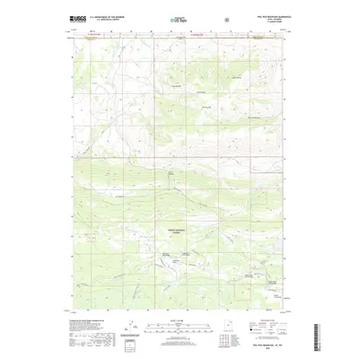
2020 Map of Phil Pico Mountain
USGS Topo · Published 2020About this map
Ashley National Forest and the rugged borderlands between Utah and Wyoming define this high-elevation landscape. The topography is dominated by the prominence of Phil Pico Mtn and Corson Peak, with drainage systems like Lodgepole Cr and Birch Cr cutting through the terrain. A notable historical alignment, the Carter Military road, traverses the central portion of the map, passing by the Carter Dugway and into the timbered reaches of the forest. Water management is a critical feature of the region, evidenced by the Interstate Canal near the northern state line and the complex of Sheep Cr Canal, Long Park Reservoir, and various irrigation structures like the Lodgepole Canal Bridge. These features illustrate the intersection of historical military transportation routes and the 20th-century development of water infrastructure required for high-altitude land use.
Find a feature on this map
37 named features on this map. Tap any name to fly to it.
Don’t see what you’re looking for? This feature index may not catch every label — zoom into the map to look around manually.
Map Details
Editions of this 2020 Phil Pico Mountain Map
This is the sole edition of this map. No revisions or reprints were ever made.
Other maps of this area

1885 · Ashley
USGS Topo · 1:250,000

1885 · Uinta
USGS Topo · 1:250,000

1905 · Gilbert Peak
USGS Topo · 1:125,000

1906 · Gilbert Peak
USGS Topo · 1:125,000

1906 · Marsh Peak
USGS Topo · 1:125,000

1908 · Marsh Peak
USGS Topo · 1:125,000

1954 · Salt Lake City
USGS Topo · 1:250,000

1954 · Vernal
USGS Topo · 1:250,000

1954 · Ogden
USGS Topo · 1:250,000

1954 · Rock Springs
USGS Topo · 1:250,000