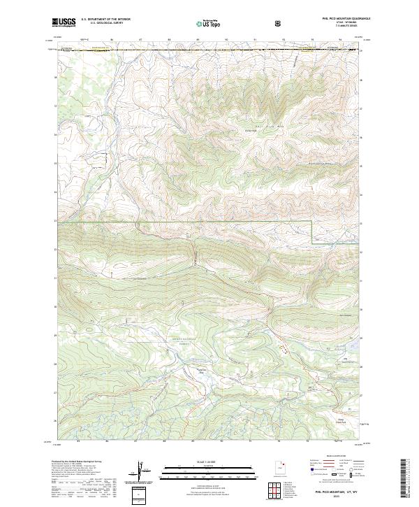
2023 Map of Phil Pico Mountain
USGS Topo · Published 2023About this map
Ashley National Forest dominates the southern half of this landscape, where the high-altitude terrain of the Uinta Mountains transitions into the high desert plains near the border between Utah and Wyoming. The map documents a significant intersection of historical transportation and water management, notably the Carter Military Trl, which follows a high ridge line above Sols Canyon. This route, along with the Carter Dugway, speaks to the nineteenth-century efforts to establish freighting paths through this demanding terrain. Below the peaks of Phil Pico Mtn and Corson Peak, the complex hydrology of the region is evident in the man-made Interstate Canal and Sheep Creek Canal. These systems, along with Long Park Reservoir, represent the critical infrastructure required to divert mountain runoff from tributaries like Lodgepole Creek for downstream use in an arid environment.
Find a feature on this map
32 named features on this map. Tap any name to fly to it.
Don’t see what you’re looking for? This feature index may not catch every label — zoom into the map to look around manually.
Map Details
Editions of this 2023 Phil Pico Mountain Map
This is the sole edition of this map. No revisions or reprints were ever made.
Other maps of this area

1885 · Ashley
USGS Topo · 1:250,000

1885 · Uinta
USGS Topo · 1:250,000

1905 · Gilbert Peak
USGS Topo · 1:125,000

1906 · Gilbert Peak
USGS Topo · 1:125,000

1906 · Marsh Peak
USGS Topo · 1:125,000

1908 · Marsh Peak
USGS Topo · 1:125,000

1954 · Salt Lake City
USGS Topo · 1:250,000

1954 · Vernal
USGS Topo · 1:250,000

1954 · Ogden
USGS Topo · 1:250,000

1954 · Rock Springs
USGS Topo · 1:250,000