
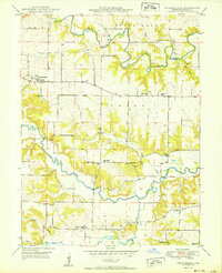
1950 Map of Philadelphia
USGS Topo · Published 1950About this map
The winding courses of the South Fabius River and North Fabius River carve through this rural corner of Marion County, where the 1950 landscape remains deeply tied to its agricultural roots and local school districts. The settlement of Philadelphia serves as a central hub, surrounded by a dense network of country schools that reflect the mid-century rural education system before widespread consolidation, including Prairie Sch, Four Corners Sch, and White Franklin Sch.
Find a feature on this map
23 named features on this map. Tap any name to fly to it.
Don’t see what you’re looking for? This feature index may not catch every label — zoom into the map to look around manually.
Map Details
Editions of this 1950 Philadelphia Map
2 editions found
Other maps of this area

1903 · Palmyra
USGS Topo · 1:125,000

1948 · Quincy
USGS Topo · 1:250,000

1949 · Durham
USGS Topo · 1:24,000

1949 · Maywood
USGS Topo · 1:24,000

1949 · Palmyra
USGS Topo · 1:24,000

1949 · Philadelphia
USGS Topo · 1:24,000
1950 · Maywood
USGS Topo · 1:24,000

1950 · Durham
USGS Topo · 1:24,000

1950 · Palmyra
USGS Topo · 1:24,000

1956 · Quincy
USGS Topo · 1:250,000