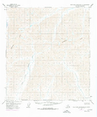
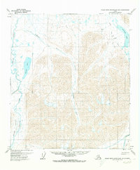
1971 Map of Philip Smith Mountains A-4
USGS Topo · Published 1997About this map
The Continental Divide snake across the high-altitude terrain of this region, separating the drainage systems of the arctic north from the interior. Much of the southern portion of the quadrangle is defined by the North Fork Chandalar River, which flows through the North Slope Borough during a period of significant geographical assessment. Revisions compiled from 1975 aerial photography highlight the ongoing efforts of the Bureau of Land Management to document unsurveyed and unmarked land lines in this remote wilderness. The map captures an era when the landscape remained largely untouched by roads or trails, serving as a baseline for the natural hydrology and topographical contours of the northern Brooks Range.
Find a feature on this map
3 named features on this map. Tap any name to fly to it.
Don’t see what you’re looking for? This feature index may not catch every label — zoom into the map to look around manually.
Map Details
Editions of this 1971 Philip Smith Mountains A-4 Map
2 editions found
Other maps of this area

1951 · Chandalar
USGS Topo · 1:250,000

1951 · Brooks
USGS Topo · 1:250,000

1956 · Chandalar
USGS Topo · 1:250,000

1956 · Philip Smith Mountains
USGS Topo · 1:250,000

1964 · Chandalar
USGS Topo · 1:250,000

1964 · Philip Smith Mountains
USGS Topo · 1:250,000
1971 · Philip Smith Mountains A-5
USGS Topo · 1:63,360
1971 · Chandalar D-5
USGS Topo · 1:63,360
1971 · Philip Smith Mountains A-4
USGS Topo · 1:63,360
1971 · Philip Smith Mountains B-5
USGS Topo · 1:63,360