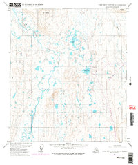
1971 Map of Philip Smith Mountains C-5
USGS Topo · Published 1977About this map
The Trans-Alaska Pipeline cuts a distinct path through this northern landscape during its mid-1970s development phase. This survey captures a pivotal moment in the industrial history of the North Slope, documenting the infrastructure required for one of the world's largest engineering projects. The presence of Toolik Lake Camp and an adjacent Landing Strip near Toolik Lake reflects the establishment of remote work sites and scientific research bases that became permanent fixtures in the Brooks Range foothills.
Find a feature on this map
11 named features on this map. Tap any name to fly to it.
Don’t see what you’re looking for? This feature index may not catch every label — zoom into the map to look around manually.
Map Details
Editions of this 1971 Philip Smith Mountains C-5 Map
3 editions found
Other maps of this area

1951 · Chandler Lake
USGS Topo · 1:250,000

1951 · Brooks
USGS Topo · 1:250,000

1956 · Philip Smith Mountains
USGS Topo · 1:250,000

1956 · Chandler Lake
USGS Topo · 1:250,000

1964 · Philip Smith Mountains
USGS Topo · 1:250,000

1964 · Chandler Lake
USGS Topo · 1:250,000
1971 · Chandler Lake D-1
USGS Topo · 1:63,360

1971 · Philip Smith Mountains C-4
USGS Topo · 1:63,360
1971 · Chandler Lake C-1
USGS Topo · 1:63,360
1971 · Philip Smith Mountains B-5
USGS Topo · 1:63,360