
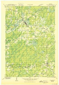
1943 Map of Philliips
USGS Topo · Published 1943About this map
The lumber and rail town of Phillips serves as the focal point for this survey, situated at the confluence of Elk Lake and Duroy Lake. During the early 1940s, the surrounding Price County landscape remained deeply defined by its rural education network, evidenced by numerous schoolhouses like the Kerr Slashing Sch and Enterprise Sch that dotted the townships. The Minneapolis St Paul and Sault Ste Marie Line provides the primary industrial artery, connecting Phillips with the junction at Prentice to the south.
Find a feature on this map
100 named features on this map. Tap any name to fly to it.
Don’t see what you’re looking for? This feature index may not catch every label — zoom into the map to look around manually.
Map Details
Editions of this 1943 Philliips Map
2 editions found
Other maps of this area

1941 · Park Falls
USGS Topo · 1:48,000

1941 · Pike Lake
USGS Topo · 1:48,000

1941 · Kennan
USGS Topo · 1:48,000

1941 · Kennedy
USGS Topo · 1:48,000

1941 · Phillips
USGS Topo · 1:48,000

1941 · Brantwood
USGS Topo · 1:48,000

1942 · Pike Lake
USGS Topo · 1:48,000

1943 · Park Falls
USGS Topo · 1:48,000

1943 · Brantwood
USGS Topo · 1:48,000

1944 · Ogema
USGS Topo · 1:48,000