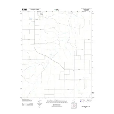
2012 Map of Phillips Camp
USGS Topo · Published 2012About this map
Phillips Camp serves as a primary reference point in this corner of the Texas Panhandle, situated near the Oklahoma border. The landscape is defined by the winding course of Coldwater Cr, which meanders across the territory, carving a drainage pattern through the high plains. The settlement pattern here is sparse, characterized by a rigid grid of rural roads designed to service the agricultural and ranching operations of Hansford County. Noteworthy thoroughfares such as Co Road C and Co Road D intersect the terrain, providing essential connectivity between isolated homesteads and larger regional hubs. The alignment of these routes, including Co Rd 11 and Co Rd 12, reflects the enduring legacy of the Public Land Survey System, which organized the vast expanses of the southern plains into the distinct blocks visible in this 2012 survey.
Find a feature on this map
13 named features on this map. Tap any name to fly to it.
Don’t see what you’re looking for? This feature index may not catch every label — zoom into the map to look around manually.
Map Details
Editions of this 2012 Phillips Camp Map
This is the sole edition of this map. No revisions or reprints were ever made.
Other maps of this area

1954 · Perryton
USGS Topo · 1:250,000

1958 · Perryton
USGS Topo · 1:250,000

1962 · Kimball
USGS Topo · 1:24,000

1968 · Guymon SW
USGS Topo · 1:24,000

1968 · Guymon SE
USGS Topo · 1:24,000

1973 · Goodwell SE
USGS Topo · 1:24,000

1973 · Gruver
USGS Topo · 1:24,000

1974 · Sunray 1 SE
USGS Topo · 1:24,000

1974 · Bernstein
USGS Topo · 1:24,000

1974 · Sunray 1 NE
USGS Topo · 1:24,000