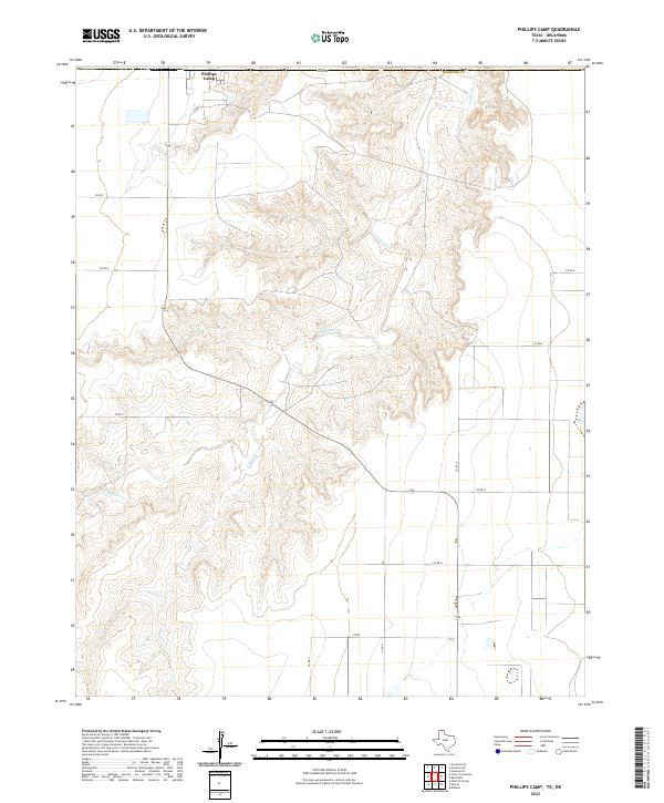
2022 Map of Phillips Camp
USGS Topo · Published 2022About this map
Phillips Camp stands as a distinct human marker in the northern Panhandle landscape, where the flat plains of Hansford County give way to the intricate drainage system of Coldwater Creek. This map captures the relationship between the straight-line geometry of the agricultural grid and the meandering natural topography of the creek’s valley. The winding course of the creek creates a network of deep-cut draws and ridges that break the open prairie, a terrain that historically dictated the placement of roads and homesteads. Local movement across this northern Texas corridor is defined by a series of graded routes such as County Road 9 and County Road D, which navigate the elevation changes where the high plains drop toward the stream bed.
Find a feature on this map
16 named features on this map. Tap any name to fly to it.
Don’t see what you’re looking for? This feature index may not catch every label — zoom into the map to look around manually.
Map Details
Editions of this 2022 Phillips Camp Map
This is the sole edition of this map. No revisions or reprints were ever made.
Other maps of this area

1954 · Perryton
USGS Topo · 1:250,000

1958 · Perryton
USGS Topo · 1:250,000

1962 · Kimball
USGS Topo · 1:24,000

1968 · Guymon SW
USGS Topo · 1:24,000

1968 · Guymon SE
USGS Topo · 1:24,000

1973 · Goodwell SE
USGS Topo · 1:24,000

1973 · Gruver
USGS Topo · 1:24,000

1974 · Sunray 1 SE
USGS Topo · 1:24,000

1974 · Bernstein
USGS Topo · 1:24,000

1974 · Sunray 1 NE
USGS Topo · 1:24,000