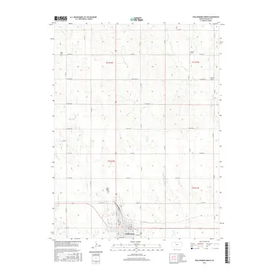
2015 Map of Phillipsburg North
USGS Topo · Published 2015About this map
Phillipsburg anchors the southern edge of this Phillips County landscape, where the local street grid is neatly organized from A St through I St and 1st St to 5th St. This area serves as a primary hub for northern Kansas, defined by its rigid section-line road network that segments the prairie into agricultural squares. Names like W Kiowa Rd, W Navajo Rd, and W Osage Rd mark these rural routes, reflecting a systematic approach to land division and movement across the plains.
Find a feature on this map
49 named features on this map. Tap any name to fly to it.
Don’t see what you’re looking for? This feature index may not catch every label — zoom into the map to look around manually.
Map Details
Editions of this 2015 Phillipsburg North Map
This is the sole edition of this map. No revisions or reprints were ever made.
Other maps of this area

1893 · Phillipsburg
USGS Topo · 1:125,000

1955 · Beloit
USGS Topo · 1:250,000

1959 · Beloit
USGS Topo · 1:250,000

1968 · Woodruff
USGS Topo · 1:24,000

1972 · Speed
USGS Topo · 1:24,000

1972 · Kirwin Reservoir
USGS Topo · 1:24,000

1972 · Phillipsburg South
USGS Topo · 1:24,000

1973 · Stuttgart NE
USGS Topo · 1:24,000
1973 · Kensington NW
USGS Topo · 1:24,000
1973 · Gretna
USGS Topo · 1:24,000