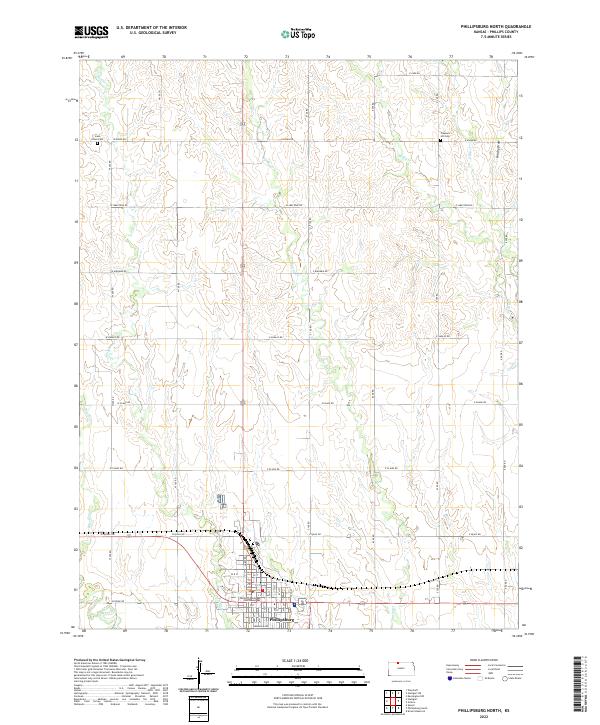
2022 Map of Phillipsburg North
USGS Topo · Published 2022About this map
Phillipsburg anchors the southern portion of this Kansas landscape, serving as a hub for the surrounding agricultural sections. The Phillips County Courthouse stands as a central landmark within the city grid, while the northern reaches of the quadrangle are defined by the headwaters of numerous small waterways including Bissell Cr, Plotner Cr, and Spring Cr. This systematic drainage pattern, carved into the plains, creates the distinctive terrain of Brushy Draw and the valleys of W Big Cr and E Big Cr.
Find a feature on this map
32 named features on this map. Tap any name to fly to it.
Don’t see what you’re looking for? This feature index may not catch every label — zoom into the map to look around manually.
Map Details
Editions of this 2022 Phillipsburg North Map
This is the sole edition of this map. No revisions or reprints were ever made.
Other maps of this area

1893 · Phillipsburg
USGS Topo · 1:125,000

1955 · Beloit
USGS Topo · 1:250,000

1959 · Beloit
USGS Topo · 1:250,000

1968 · Woodruff
USGS Topo · 1:24,000

1972 · Speed
USGS Topo · 1:24,000

1972 · Kirwin Reservoir
USGS Topo · 1:24,000

1972 · Phillipsburg South
USGS Topo · 1:24,000

1973 · Stuttgart NE
USGS Topo · 1:24,000
1973 · Kensington NW
USGS Topo · 1:24,000
1973 · Gretna
USGS Topo · 1:24,000